Site Development
Laying the Groundwork for Every Project
From surveying and mapping to site planning and design, we provide accurate, efficient solutions that lay the groundwork for successful projects of every scale.
Development Services
Expert solutions that start every project off right.
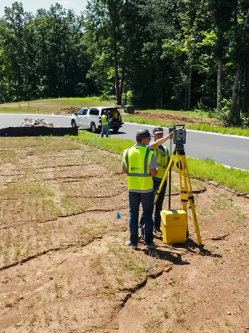
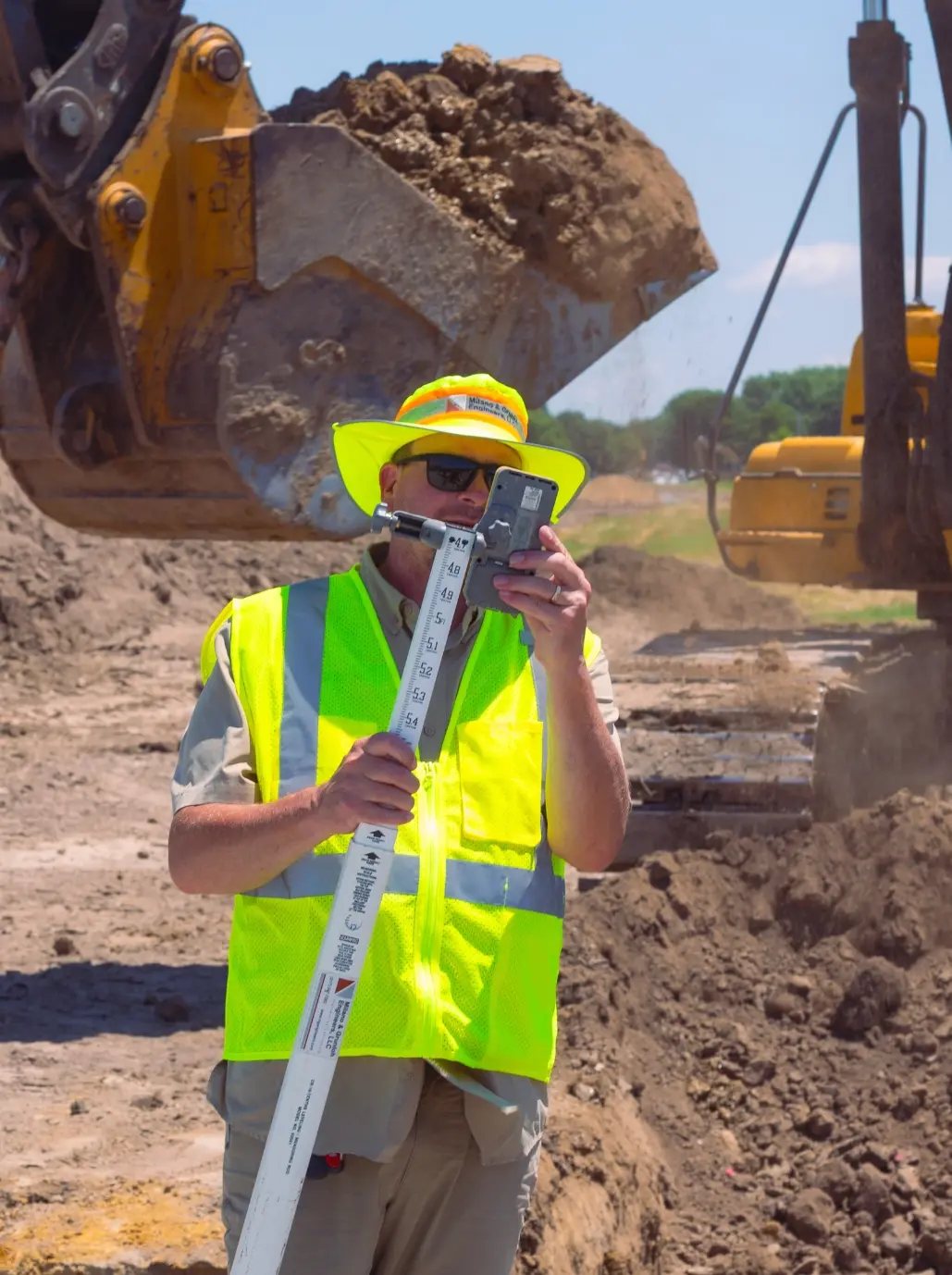
Our surveying and mapping services provide precise measurements and data to guide every stage of site development. Using advanced technology, we capture topography, boundaries, and site features for accurate planning.
From site planning to detailed design, we work closely with clients to create efficient, buildable solutions that set every project up for long-term success.
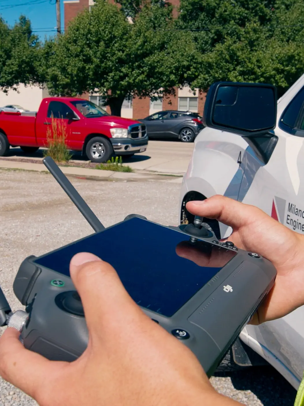
Drone / Lidar / Photogrammetry
High-precision aerial data collection that delivers accurate mapping and detailed site insights.
Drone Surveying
Drones capture high-resolution aerial images and videos, providing fast, accurate site data for monitoring progress, documenting conditions, and supporting better project decisions.
LIDAR Mapping
LiDAR uses laser scanning to create precise 3D models of terrain and structures. It delivers highly accurate topographic data, even through vegetation, to support site planning.
Photogrammetry
Photogrammetry turns aerial photography into detailed 2D maps and 3D models. It offers an efficient and cost-effective way to capture site features and measurements.
Surveying & Site Mapping
Delivering precise measurements and data to guide planning, design, and construction.
01
Aerial Photo Control Surveys
Establishes precise ground reference points to support accurate aerial mapping and photogrammetry.
02
Boundary / ALTA Surveys
Determines property lines and provides detailed surveys for title, legal, and development purposes.
03
Land Surveying
Measures and maps land features, topography, and property boundaries for planning and construction.
04
Railroad Engineering
Provides specialized surveys and layouts for railroad design, construction, and maintenance projects.
05
Right of Way Location & Staking
Marks and maps property rights and easements for infrastructure projects and legal compliance.
06
Site Feasibility Studies
Evaluates site conditions and constraints to determine the best use and development potential.
07
Storm Water Studies
Analyzes drainage and runoff patterns to design effective stormwater management systems.
08
Topography / DTM Survey
Creates detailed maps of land elevations and contours to guide engineering and construction.
09
Global Positioning Surveying
Uses GPS technology for accurate, efficient mapping and data collection across projects.
Site Planning & Design
Thoughtful planning and design that set the foundation for successful, long-lasting sites.
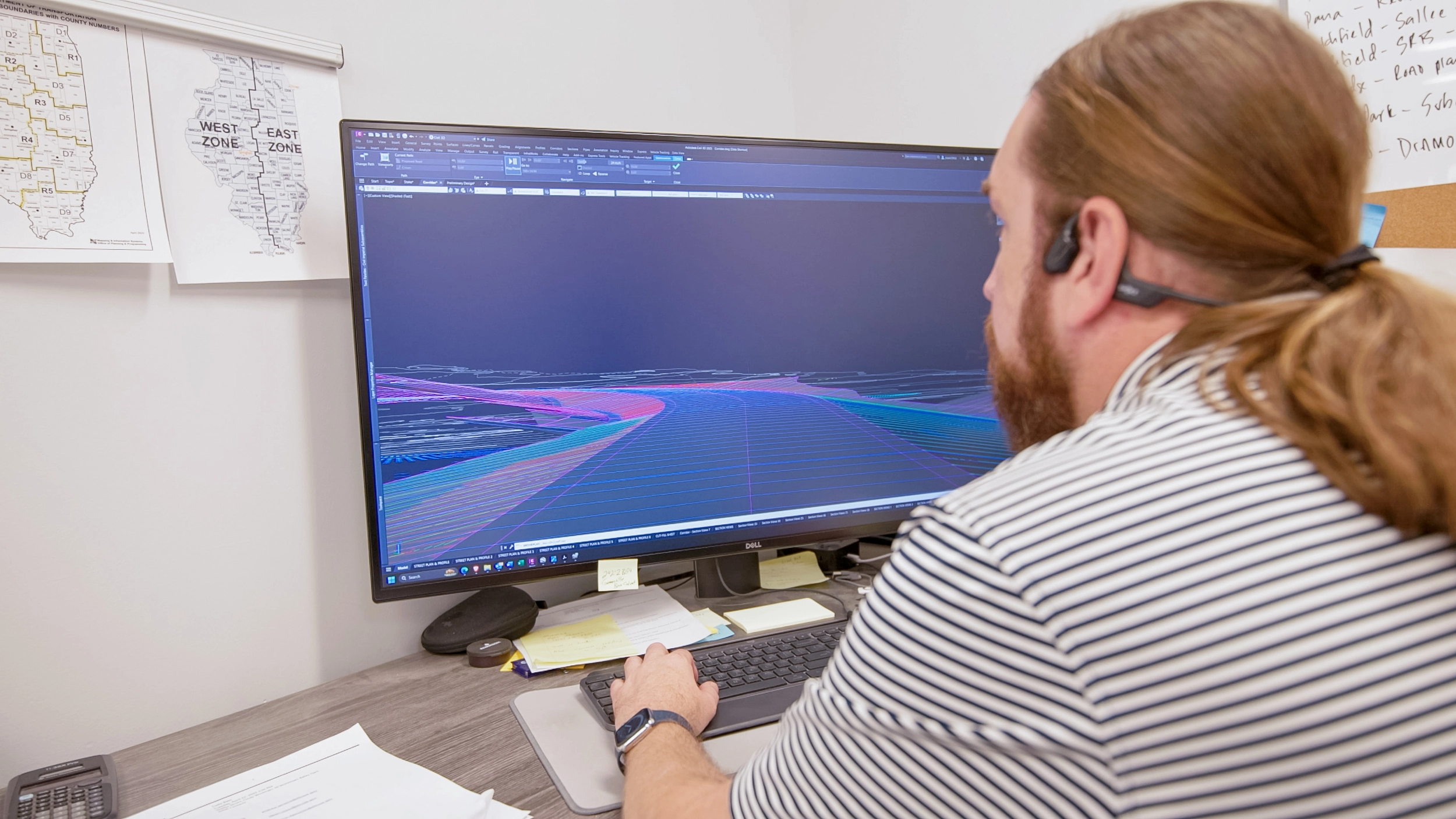
Our team works closely with clients to create site plans that not only meet technical requirements but also support broader goals like accessibility, sustainability, and aesthetic appeal. From initial concepts to detailed layouts, we focus on designs that make the best use of available land while preparing for future growth.
Every project is approached with both precision and practicality in mind. Whether it’s coordinating utilities, addressing drainage, or optimizing traffic flow, our goal is to deliver site designs that are efficient, cost-effective, and built to last. By combining proven engineering practices with innovative solutions, we help transform ideas into sites that work for both people and communities.